Some weeks ago Google announced that it was sun-setting Google Fusion Tables.
Fusion Tables was often used by journalists, scientists, and others interested in quickly plotting data on a Google Map without having to do any coding. Google encouraged users to switch to other products, like its BigQuery cloud data warehouse system, its Google Data Studio business intelligence tool, or simply Google Sheets. The company says it’s also working to make other mapping tools, currently used internally, available.
“RIP Fusion Tables: Google is killing off the beloved data visualization tool“, 12.11.18, Fast Company, Steven Melendez
Fusion tables was not widely used but I used it and I frequently recommended it to students and those interested in mapping who weren’t familiar with GIS (Geographical Information Systems) or those unwilling to learn how to cobble together geospatial data with geospatial javascript libraries.
And so I believe I will be switching my go-to recommendation for easiest geospatial tool to Google Earth. This is counter-intuitive, I know. Why use Google’s globe software to make a map? Why not use Google Maps?
Well for one, while Google Maps does allow data to be imported, it won’t accept import files that are over 5 MB.
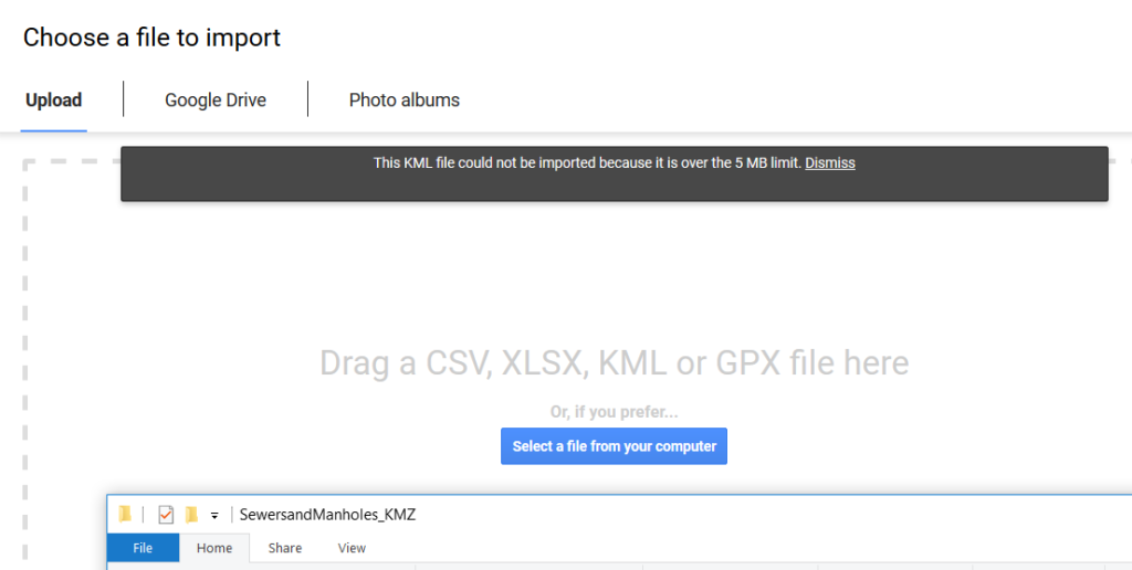
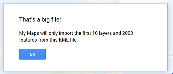
And data files that are smaller than 5MB won’t open if they are more than 10 layers or have more than 2000 features.
In the example above, I was trying to import some geospatial data about sewers from the City of Windsor Open Data Catalogue.
From the FAQ of the Water Resources page of the City of Windsor:
The majority of residents are serviced with either sanitary and storm sewers or by a combined sewer system.
– Storm Sewers carry stormwater runoff only. Storm Sewers eventually drain to the Detroit River, untreated. There are 732 kilometres of storm sewers within the City of Windsor
– Sanitary Sewers are designed to convey human domestic waste only to the City’s Waste Water Treatment facilities. The City of Windsor maintains approximately 675 kilometres of sanitary sewers.
– Combined Sewers were constructed throughout the City until the 1950s. Combined Sewers carry both storm water and sanitary waste. The City of Windsor is working towards replacement of the 228 kilometres of combined sewers with a separated system (separate sanitary and storm) where practical. Unfortunately, this will not happen quickly.
If we want to see these sewer systems in a map, one way to go about it is to download the SewersandManholes_KMZ.zip file from its City of Windsor Open Data Catalogue page and to ‘unzip it’ to find all of its components.

Then one can open these files in Google Earth.
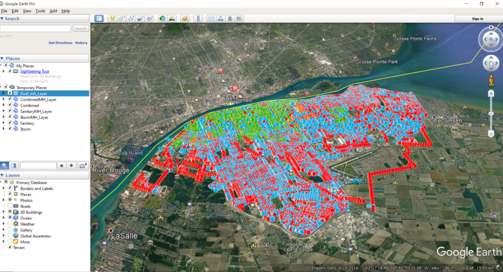
Notice that in the left hand column there are check marks for each of the different type of sewer systems. I opted to select only the Combined sewer system and I changed its default colour from green to yellow so it could be more visible. Now we can easily see where the 228 kilometres of combined sewers are distributed in the city.
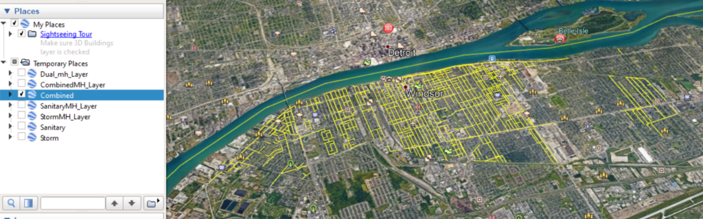
There are other benefits to using Google Earth to explore the City of Windsor. If you zoom in enough, Google Earth will change its point of view to Google Street View. I know that under the street where I live is a combined sewer system!
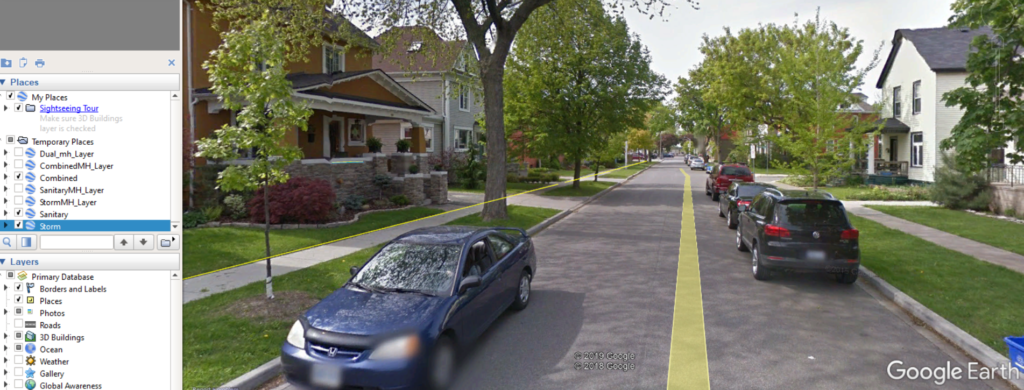
If you virtually drive a couple blocks over and you can see both a combined sewer line as well as a storm sewer line (in blue).

And that is how to you can use Google Earth to look under the streets that you live.