Table of Contents
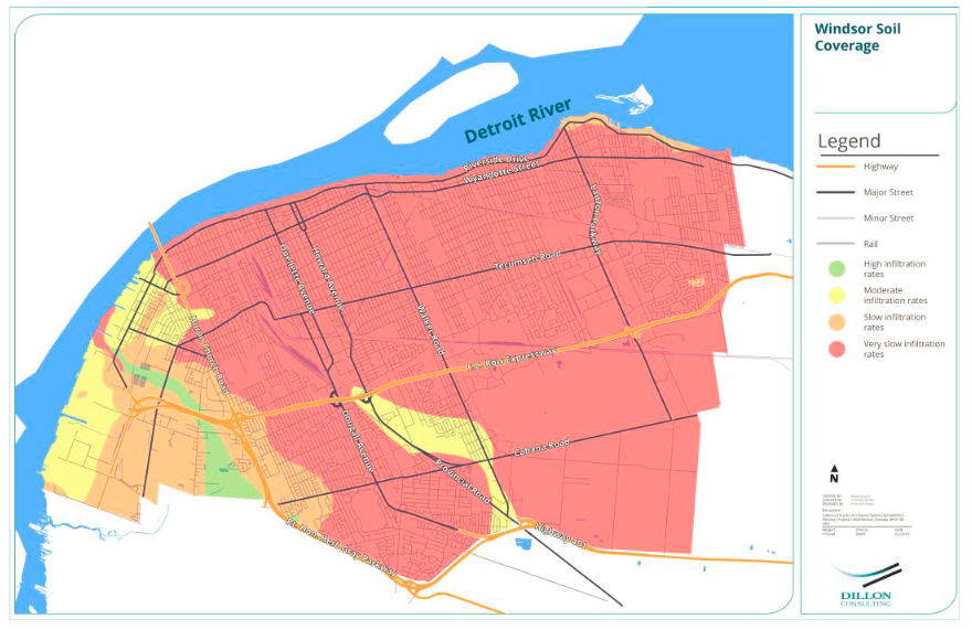
Lack of forests and wetland
“Essex County, which is upstream of you, has the lowest rate of wetlands and woodlands in Ontario — only 3 per cent of trees, and only about 1.5 per cent of wetlands,” Saxe explained to CBC News. “The minimum necessary for a healthy ecosystem and some kind of reasonable flood resilience is 30 per cent woods and 10 per cent wetlands.”
2018 Environmental Protection Report, Environmental Commissioner of Ontario.
A typical medium sized tree can intercept as much as 2,380 gallons of rainfall per year.
Incentive to increase natural coverage?
- Stormwater credits [Kitchener, Ontario]
- Stormwater credit program [Mississauga, Ontario]
- For comparison’s sake: Windsor’s Stormwater Management and the Stormwater Financing Study
South Cameron Woodlot
Mapping
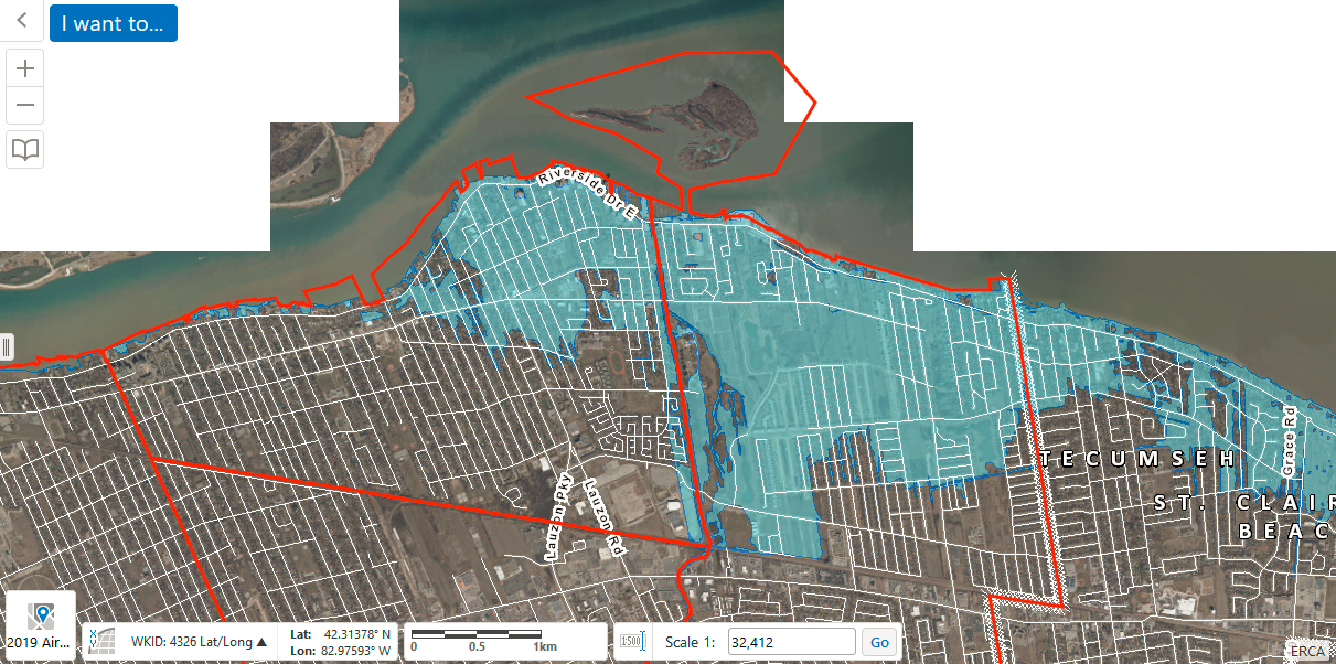
The Essex Region Conservation Authority offers flood-relating information with it’s interactive mapping tool Map Your Property featuring 2019 air photos. As this is a ESRI GIS map, it can appear pretty confusing to people who are used to web interfaces like Google Maps which are more intuitive. It took me a moment, but I found the option to search for an address under the Workflows tab. Unfortunately, it appears that you can only search for county parcels.

Before we begin, I would be remiss if I didn’t mention that the flood maps of our county are terribly out of date. For what it’s worth, there’s the 1:100 Flood line for the city of Windsor.

While the city boundaries are available, the ward lines of the city are not in the map. We can add these by grabbing the necessary zip files from the Windsor Open Data Catalogue.

——
Municipal Drains
On September 4th, the Windsor Star printing a frankly bizarre guest column from retired political science professor, Lloyd Brown-John about municipal drains. Brown-John suggests that our flooding is the fault of “the original geography of the land” (conveniently neglecting that the original geography of the land was once 100% naturalized and now Essex County only has 3% of remaining woods and wetlands to absorb and slowly distribute water). We get a short history lesson on the first drains in Chatham-Kent and an update about two current municipal drainage projects: one in Kingsville and one in Leamington. It ends with this bizarro line: “Isn’t it marvelous how we get to pay for water in so many ways — like owning a boat — that hole in the water into which one pours money”. Wait, what?
Are municipal drains worth knowing about? I don’t know. I do know that some of them have names which suggests that they might be a particularly interesting bit of infrastructure. This is what I have found about municipal drains in Windsor. First, from the city’s website:
- The City of Windsor maintains approximately 256 kilometres (160 miles) of roadside ditches and 146 kilometres (91 miles) of municipal drains.
- The property owner is responsible for the maintenance (weed cutting) of the roadside ditch or drain including the removal of any litter or debris as outlined in By-Law #3-2006: Yard Maintenance
While the above suggests that property owners are responsible for drains, it appears that larger municipal drains are the responsibility of various levels of government. From this 2015 Windsor Star article “Business owner frustrated at overgrown state of municipal drain“, I learned that municipal drains typically have maintenance done every 10 to 15 years.
Drains with names!
- Grand Marais Drain
- 3rd Concession Drain
- Howard Ave Drain
- Burke Drain
- Cahill Drain
- Lennon Drain
- Basin Drain
Bridges and Culverts
The City of Windsor maintains 84 bridges and 216 municipal culverts (3 metres/9 feet or greater). Repairs include parapet walls, bearing plates, deck rehabilitation, foundation repairs, bridge washing, and total reconstruction. Culverts in a driveway are the property owner’s responsibility to repair or replace at their own expense. A permit from Public Works (3rd Floor, 350 City Hall Square West) is required to do this.
City of Windsor Bridge Maintenance