
Over the Winter Break, I found myself with delicious stretches of time in which I had nothing that I had to do. I played board games with my family. I read books. I also carved out a little bit of time to do some civic engagement. From the Detroit River Cleanup The Current newsletter, I learned that…
The City of Windsor released their 2019 Draft Climate Change Adaptation Plan and Climate Change Impacts in Windsor – A Technical Document. These items are tabled for public comment until January 20, 2020, and any comments can be sent to emp@citywindsor.ca.
This is not going to a blog post about this report. Instead, I want to focus on one specific matter it touches upon that I simply cannot understand:
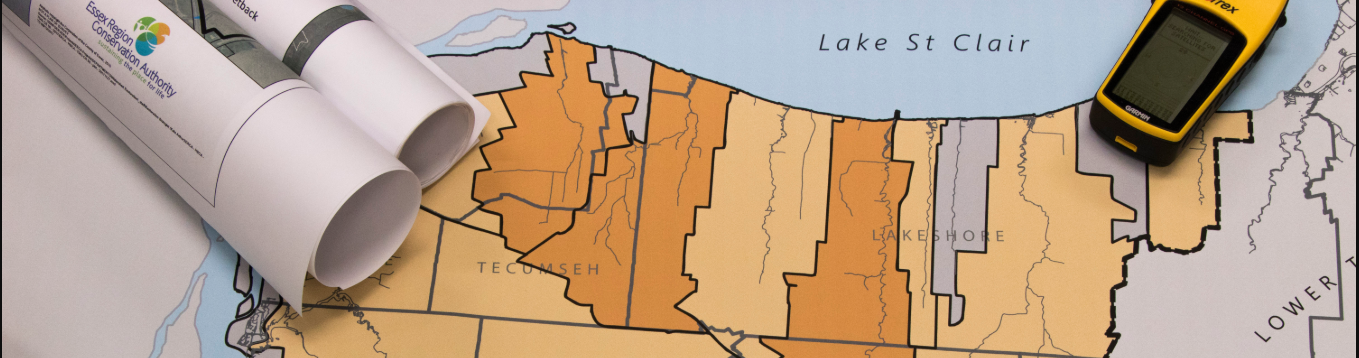
With flooding remaining widespread across the local area, the Essex Region Conservation Authority has called on the need to update flood mapping throughout Windsor and Essex County.
“ERCA extends flood watch, calls for updated data mapping across local region“, Dave Battagello, Windsor Star, July 16, 2019
New modelling and land surveys, potentially at a cost of between $8 million to $15 million, needs to be done to better understand challenges that lie ahead in future years for every local municipality impacted by flooding, said Tim Byrne, ERCA’s director of watershed management services.
Flood mapping would allow areas of concern to properly prepare — including setting municipal budget funds aside — so flooding as it occurs can be properly addressed, he said. It would provide blueprint support for municipal planning, road building, infrastructure construction and residential development.
The last time flood mapping was completed in this region was in the late 1970s, Byrne said.
I intended to write a review of the draft Climate Change Adaptation Plan, but shortly after I started, I remembered reading the Windsor Star article quoted above. I broke off my reading to search for the word map in the Climate Change Adaption Plan and found this:
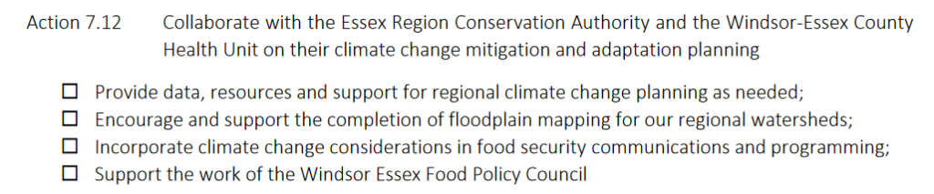
According to this document, The City of Windsor will encourage and support the completion of floodplain mapping of our region but the responsibility for this project appears to sit with the Essex Region Conservation Authority. So I went to check their budget to see if floodplain mapping would be addressed in ERCA’s budget, which was recently released.
When I reviewed ERCA’s budget, I immediately realized the problem at hand. To update our floodplain maps will take between $8 to $15 million dollars. ERCA’s total annual budget for 2020 is just over $10.5 million.
Last year, the Ford government cut their funding towards flood management.
Doug Ford’s government tabled its first budget last Thursday. The next day, the Ministry of Natural Resources informed conservation authorities about the new funding formula. For ERCA, the change represents the loss of $100,000 annually. In previous years, ERCA received $202,000 from the province for flood management and that amount is matched through municipal funding for a total flood management budget of $404,000.
“Ford government slashes ERCA flood management funding“, The Windsor Star, Mary Caton, April 17 2019
The province only funds between two and three per cent of ERCA’s annual $7.8 million budget, but according to Wyma the Ontario government has regulatory control over conservation authorities.
“ERCA faces provincial funding uncertainty“, The Windsor Star, Jennifer La Grassa, September 16, 2019
Local municipalities fund about 30 per cent of the budget and the remainder is through federal grants, fees for service and individual sector support.
Just short weeks ago, in November of this year, the City of Windsor proclaimed that we are experiencing a climate emergency. Essex County did the same and then, so did Amherstburg Town Council. I hope these declarations suggest that the City of Windsor, along with the other municipalities of Essex County, are ready and prepared to significantly invest in ERCA so we collectively can better understand, cope with, adapt to, and mitigate the effects of increased flooding in our region.
Otherwise we are going to keep running into scenarios like this one:
Restoration efforts on Peche Island trails that became submerged by a rising Detroit River will keep visitors’ feet dry for now, but rising lake levels could flood the paths again.
“City restores flooded Peche Island trails in advance of boat tours“, The Windsor Star, Taylor Campbell, July 2, 2019
In an effort to combat the waterlogged walkways, which forced the City of Windsor to delay municipal boat tours to the island by two weeks, city workers have elevated affected trails with gravel by about seven inches (18 cm), said Trese MacNeil, the city’s co-ordinator of community sports services, recreation and culture. Workers also slightly rerouted some trails to keep them dry with “as little impact to the natural environment as possible,” she said.
The trails are now safe to welcome the first shuttle riders of the season on Wednesday, MacNeil said, but there’s “no way of knowing” if water levels forecasted to rise will flood the fixed paths.
No way of knowing if water levels will flood the fixed paths? I have a hard time believing that. There are GIS (Geographic Information Systems) that do this exact type of modelling. But these systems can only model information that has been captured and prepared. Or in other words, mapped.
We need to update our out of date, 40+ year old floodplain maps.
Addendum: It appears that Lakeshore has started contracting this work. They have “budgeted $40,000 to have Stantec Consulting Ltd. and Zuzek Inc. analyze and map municipal shorelines.” Work that that haven’t been done since 1976.